View
Tube
search
Sign in
Sign up
Subscriptions
FOSS4G
FOSS4G 2019 Bucharest
5,286 views
291 items
Last updated on Oct 22, 2019
public playlist
FOSS4G
19:13
2019 - Running QGIS Server in production
FOSS4G
26:23
2019 - Field data collection strategies - using QField and QGIS
FOSS4G
26:31
2019 - Using a QGIS for small scale agriculture mapping
FOSS4G
23:50
2019 - Shortest path in the database and more with pgRouting
FOSS4G
27:34
2019 - Lizmap to create Web Map Applications
FOSS4G
22:45
2019 - Spatial Support in MySQL
FOSS4G
25:17
2019 - Fun with Foreign Data Wrappers (FDW) and PostgreSQL
FOSS4G
23:31
2019 - Mesh: GIS data beyond raster and vector
FOSS4G
24:53
2019 - QWC2 viewer for QGIS server with micro service architecture
FOSS4G
24:16
2019 - Creating Stunning Maps in GeoServer, with SLD, CSS, YSLD and MBStyles
FOSS4G
26:09
2019 - PyQGIS the comfortable way - tricks to efficiently work with Python and QGIS
FOSS4G
16:30
2019 - 3D geo data in the Mapbox-gl viewer with 3D tiles
FOSS4G
29:09
2019 - CNN-based tools in GRASS GIS
FOSS4G
25:11
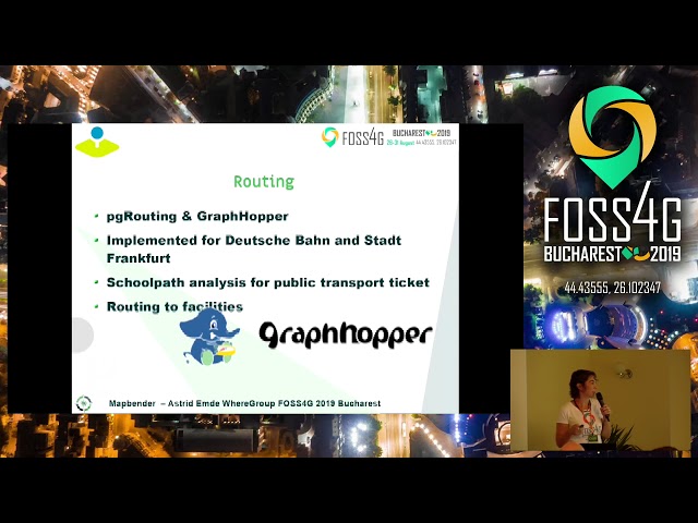
2019 - Create Web Application with Mapbender
FOSS4G
28:13
2019 - What’s new in OSGeoLive 13.0 ?
FOSS4G
17:54
2019 - Algorithm Walk-through: How to Visualize a Large GeoTIFF on Your Web Map
FOSS4G
21:58
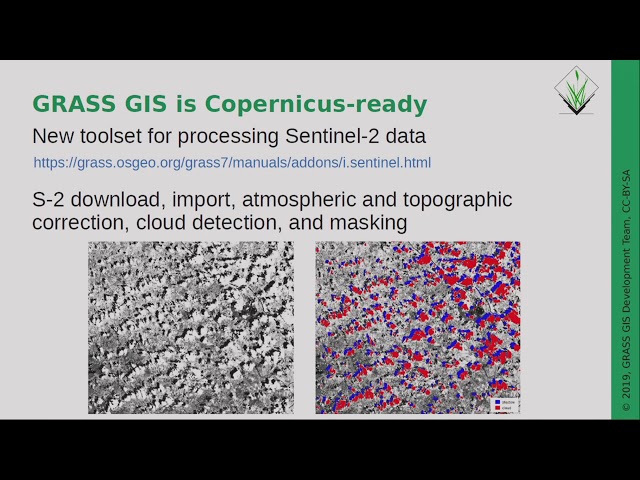
2019 - State of GRASS GIS Project: 35 years is nothing!
FOSS4G
1:35:35
2019 - QGIS on the road
FOSS4G
25:15
2019 - OpenLayers 6 - There And Back Again
FOSS4G
27:21
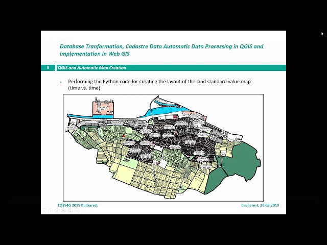
2019 - Database Transformation, Cadastre Automatic Data Processing in QGIS and Implementation in Web
FOSS4G
26:47
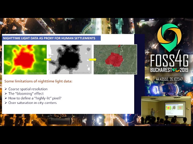
2019 - Remote Sensing Analysis for Urban Research at Scale
FOSS4G
25:50
2019 - Deep Transfer Learning for Land Cover Classification on Open Multispectral Satellite Imagery
FOSS4G
26:27
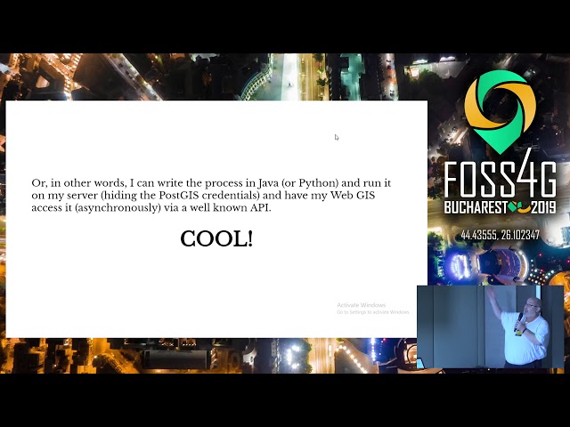
2019 - Using the OGC Web Processing Service (WPS) to move business logic to the server
FOSS4G
24:30
2019 - Introduction to MapStore, mashups made simple
FOSS4G
22:53
2019 - GeoServer WFS3: introduction to the RESTful, schemaless, JSON first download service
FOSS4G
24:24
2019 - Data Science with OpenStreetMap and Wikidata
FOSS4G
23:55
2019 - Exploiting PDAL + Entwine in the wild
FOSS4G
26:43
2019 - Creating Wallonia's new very high resolution land cover maps: combining GRASS GIS OBIA and O
FOSS4G
26:11
2019 - State of GeoNode
FOSS4G
27:50
2019 - Battle of 3D Rendering Stacks: CesiumJS, VTS Geospatial or iTowns?
FOSS4G
23:43
2019 - Discover huge raster files in the Browser with geotiff.js
FOSS4G
22:27
2019 - Standing up a OSM clone with GeoServer and CSS
FOSS4G
16:12
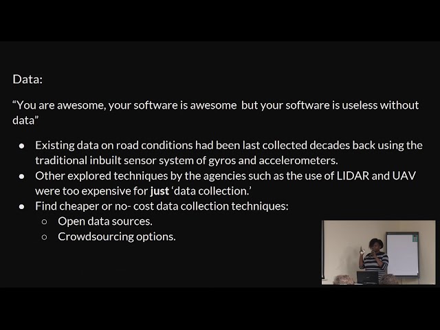
2019 - Developing a GIS-based roads maintenance management system
FOSS4G
20:21
2019 - State of MapServer
FOSS4G
22:27
2019 - WPS with Qgis processing - From desktop to server
FOSS4G
27:48
2019 - What's new in PostGIS
FOSS4G
22:43
2019 - One Geonode, many Geonodes
FOSS4G
20:28
2019 - Building a geo marketing tool with open source geospatial software
FOSS4G
22:34
2019 - Three-D Change Detection: A QGIS Plugin with Python 3
FOSS4G
21:09
2019 - Free and Open Meteorological and Climate data - what is missing?
FOSS4G
30:20
2019 - OSS Technologies in Modelling Spatial Accessibility of Primary Health Care in Malawi
FOSS4G
19:16
2019 - Automating Image-Based Boundary Delineation
FOSS4G
22:02
2019 - QGIS is dead, long live QGIS! - the very best new features of QGIS 3.x
FOSS4G
23:10
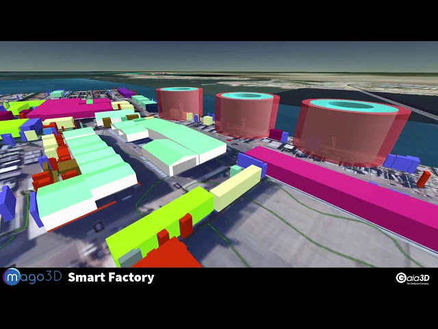
2019 - Current Status of mago3D, an Open Source Based Digital Twin Platform
FOSS4G
31:03
2019 - GeoEasy, free surveying calculations
FOSS4G
18:59
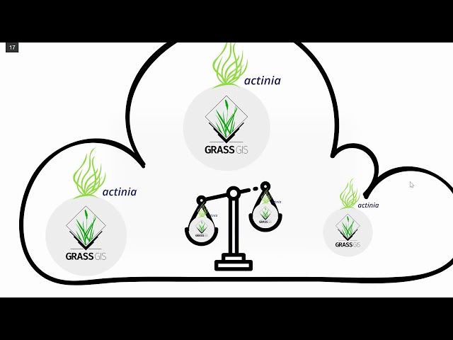
2019 - GRASS GIS in the cloud: actinia geoprocessing
FOSS4G
26:48
2019 - Crunching Data In GeoServer : Mastering Rendering Transformations, WPS Processes And SQL View
FOSS4G
28:18
2019 - G3W-SUITE: a new framework for the QGIS projects WEB publication.
FOSS4G
23:37
2019 - How will you use Orfeo ToolBox in the next few years ?
FOSS4G
23:30
2019 - Case Study of Non-Revenue Water Management of Narok water in Kenya
FOSS4G
14:50
2019 - Cesium applications made awesome with TerriaJS
FOSS4G
25:50
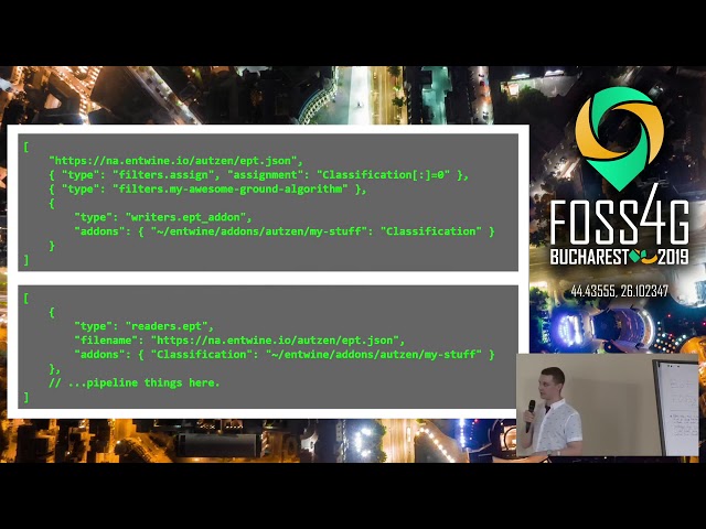
2019 - Continental Scale Point Cloud Data Management and Exploitation with Entwine
FOSS4G
28:25
2019 - A COG In The Machine - Using Cloud Optimised GeoTiffs to Query 24 Billion Pixels In Real-Time
FOSS4G
24:52
2019 - QGIS 3D: current state and future plans
FOSS4G
22:59
2019 - The Open Data Cube Sandbox
FOSS4G
23:01
2019 - Geodesic algorithms: an experimental study
FOSS4G
25:40
2019 - The secret life of open source developers
FOSS4G
21:41
2019 - SAGA GIS 7.3 - new LTR
FOSS4G
25:29
2019 - A digital 3D maquette on country scale with pointclouds, postgis, 3D tiles and cesium
FOSS4G
22:51
2019 - SHOGun, GeoServer & QGIS Integration: Manage WebGIS Applications from your Desktop
FOSS4G
29:37
2019 - Deforestation Monitoring using Change Detection
FOSS4G
22:31
2019 - vts-mapproxy - The 3D Geospatial Streaming Server
FOSS4G
18:00
2019 - Analyzing floating car data with clickhouse db, postgres and R
FOSS4G
20:13
2019 - OSGeo: Your Open Source Compass
FOSS4G
13:36
2019 - Up and Running with Martin
FOSS4G
17:36
2019 - Metadata workflow, history and draft in GeoNetwork
FOSS4G
21:57
2019 - Next generation OGC web services with pygeoapi
FOSS4G
23:26
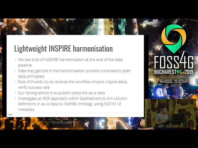
2019 - One click data publishing for QGIS to support OGC/INSPIRE
FOSS4G
21:34
2019 - Visual Hierarchies in 3D Cartography with vts-geospatial
FOSS4G
26:19
2019 - Geopaparazzi state of the art of the digital field mapping application
FOSS4G
25:55
2019 - Gisquick: Let’s share GIS much quicker
FOSS4G
21:17
2019 - JuliaGeo: A Fresh Approach to Geospatial Computing
FOSS4G
22:44
2019 - From desktop to spatial data infrastructure with QGIS
FOSS4G
25:04
2019 - Open source tool set for geology
FOSS4G
23:00
2019 - Big Data above and beyond, OpenLayers and Power BI working together
FOSS4G
14:27
2019 - Welcome speech from Mr. Dumitru Prunariu, Romanian Space Agency
FOSS4G
23:58
2019 - geOrchestra - INSPIDE SDI
FOSS4G
19:36
2019 - Flood Vulnerability Index for coastal communities linked to mangrove forests based on the COA
FOSS4G
22:03
2019 - State of GeoExt
FOSS4G
20:31
2019 - Input: A touch friendly mobile app for data collection
FOSS4G
25:08
2019 - Computer Vision at scale with RoboSat.pink
FOSS4G
21:53
2019 - Custom workflows in QGIS thanks to Python - a non technical introduction
FOSS4G
25:50
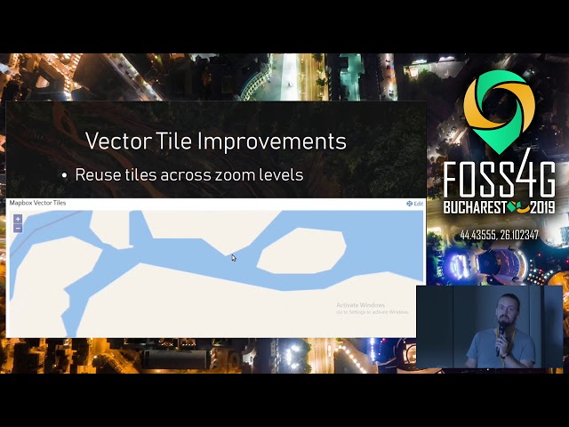
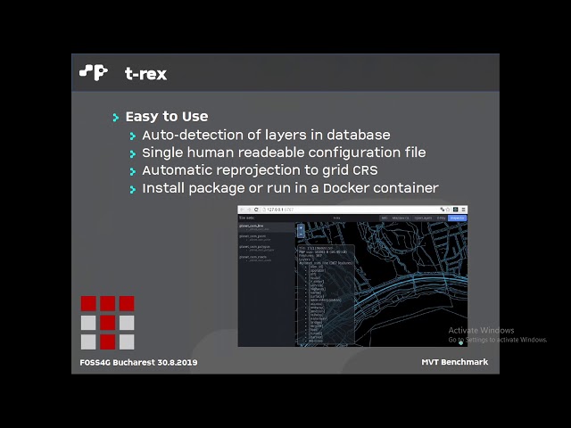
2019 - Vector tile benchmark
FOSS4G
23:46
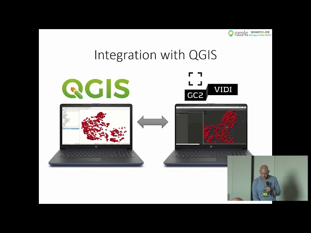
2019 - GC2/Vidi: What’s new in the spatial data infrastructure project
FOSS4G
20:25
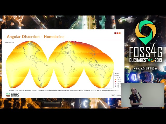
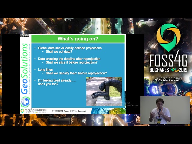
2019 - ISRIC:152160 - The Homolosine Projection in a Big Spatial Data framework
FOSS4G
26:50
2019 - State of GeoServer 2019
FOSS4G
26:08
2019 - OMERO: an open source tool for a cross-disciplinary geospatial Odyssey
FOSS4G
19:00
2019 - OpenEO: Earth Observation data cubes
FOSS4G
25:40
2019 - State of PyWPS
FOSS4G
22:52
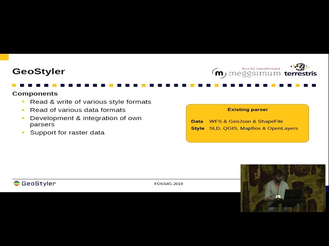
2019 - GeoStyler - a generic graphical style editor for geodata
FOSS4G
21:11
2019 - GeoNetwork Opensource: What’s Happening and Upcoming
FOSS4G
27:59
2019 - From visualization to analysis. Stop using heatmaps to discover spatial patterns
FOSS4G
29:23
2019 - HERE XYZ Deep Dive on Creating Custom Web Maps
FOSS4G
18:37
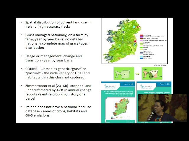
2019 - Processing and refining European Land use Inventory LUCAS for National Needs: A Case study –
FOSS4G
25:44
2019 - Mapping the world beyond Web Mercator
FOSS4G
18:04
2019 - BruGIS Data Management (BDM) : QGIS plugins to manage and edit data
FOSS4G
24:52
2019 - Safer Navigation Using Electronic Navigational Charts, AIS and RADAR Data powered by FOSS4G
FOSS4G
28:07
2019 - MapML: The (new) "map" HTML element, now in MapServer, GDAL and OGR
FOSS4G
19:36
2019 - inous Initiative - An eco-system for OGC IndoorGML
FOSS4G
26:14
2019 - State of GDAL